The Narrow Neck was within the (Jaredite) Land Northward and was bounded by a sea on its west and east and was described as being “small” (Alma 22:32) and “narrow” but was not “1.5 days wide” as traditionally taught. Relevant verses:
5 And it came to pass that Hagoth, he being an exceedingly curious man, therefore he went forth and built him an exceedingly large ship,
on the borders of the land Bountiful,
by the land Desolation, and
launched it forth into the west sea,
by the narrow neck [the N.N. was not part of Bountiful, but was WITHIN the L.N.; IT WAS NOT A PENINSULA]
which led into the land northward. (Alma 63)
Stated in reverse, there’s a Narrow Neck by the West Sea that led into the (Jaredite) Land Northward and was part of the Land Desolation. An additional detail of the Desolation / Bountiful juncture was the “Sea Divides the Land” that did “divide” those lands:
19 And it came to pass that Lib also did that which was good in the sight of the Lord. And in the days of Lib the poisonous serpents were destroyed. Wherefore they did go into the land southward, to hunt food for the people of the land, for the land was covered with animals of the forest. And Lib also himself became a great hunter.
20 And they built a great city by the NARROW NECK OF LAND,
by the place where the SEA DIVIDES THE LAND. (Ether 10)
The “Narrow Passage” was the same as the Narrow Neck:
29 And the Lamanites did give unto us the land northward, yea, even to the narrow passage which led into the land southward. And we did give unto the Lamanites all the land southward. (Mormon 2)
History
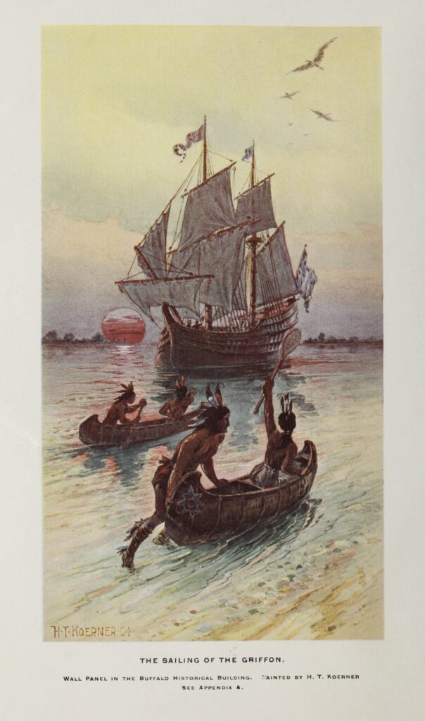
“Originating from several springs in Lancaster and flowing to its outlet at Black Rock on the Niagara River, Scajaquada Creek is about 13 miles long, its entire watershed only 29 square miles. The early explorer Robert LaSalle’s Griffon was launched here in 1679 and America’s first naval yard was established near its mouth in 1812 to help build Perry’s Lake Erie fleet…” (Prof. Gerry Rising, Buffalo Sunday News, September 23, 2007, http://www.acsu.buffalo.edu/~insrisg/nature/nw07/0923Scajaquada.htm; http://www.acsu.buffalo.edu/~insrisg/nature/).
Tonawanda Island
• CANAL TERMINUS: Today, the Erie Canal ends in Tonawanda where Tonawanda Creek empties into the Niagara River after passing under the Seymour-River Road Bridge. But for the first 100 years of its existence, the canal continued from Tonawanda to Buffalo, passing directly through downtown Tonawanda between what’s now McDonalds and the HSBC First Trust Bank, along the right-of-way of the current Niagara Street arterial and through the length of Niawanda Park and Isle View Park
• BISON SHIPYARD: As one looks at the southeastern end of Tonawanda, there is a very large building that was at one time a trucking terminal and is now some kind of a manufacturing facility. This end of the island at one time was time home of docks and lumber piles which helped to make North Tonawanda the lumbering capitol of the world. Prior to World War II, those seven acres at the end of the island were occupied by Hill Manning Boat Company. A partnership of two Buffalo industries, Ernst Iron Works and August Feine and Sons, obtained contracts to build a type of landing craft called Landing Craft Tank. The steel was cut and sized in Buffalo plants, and the boats were put together on Tonawanda Island. Navy personnel would take charge of the LCT, and most were taken up the Erie Canal for use overseas. Some 353 LCTs were built by Bison Ship Building Company and its 800 workers from 1942-44.
• TONAWANDA ISLAND: In “ History of the Holland Purchase” by O. Turner (1849), it is noted that there was located an ancient mound on the southeast end of the island that earliest settlers described as at least 10 feet tall and 25 feet in diameter. A large number of human bones, as well as arrows, beads and hatchets, were removed over the years. The site was eventually evacuated by E. G. Squier, a well-known archaeologist who credited the site as belonging to Neuter Indians, who were early inhabitants and known for gathering bones and burying them in one place. A second site at the northern part of the island was discovered at the end of the 18th century and was described as 15 feet high and encircled by stones which had traces of fire. The diameter was about 10 feet and contained three to four skeletons, as well as worked flint, broken points and antlers.
• TONAWANDA ISLAND, PART II: Opposite the ancient mound on the southeast section near where the Little River meets Tonawanda Creek (or, if you please, the Erie Canal) there was discovered in the late 1800s or early 1900s what may have been an ancient armory or remnants of prior residence. In an area of earth were found chips of flint, refuse pieces and imperfect arrows. Also recovered were pottery shards, pipe bowls, pipe stems and various tools While North Tonawanda was being settled, plows would uncover various items. At one time, Cornelius Creek ran through the area. Information regarding this site is sparse. Archaeologists recovered artifacts that they believed to have been created between 6000 B.C. and 1600 A.D. (Town of Tonawanda Compiled by John Percy, town historian; https://www.niagara-gazette.com/news/lifestyles/lifestyle-a-peek-at-the-tonawandas-hidden-history/article_c1b11d8b-e434-5895-9528-4e5329af359a.html)
More information: https://bookofmormongeography.org/lands/narrow-passage/.